|

Geography
and climate

Dead Sea
Israel is located at the eastern end of the
Mediterranean Sea, bounded by Lebanon to the north, Syria
to the northeast, Jordan to the east, and Egypt to the
southwest. The sovereign territory of Israel, excluding
all territories captured by Israel during the 1967 Six-Day
War, is approximately 20,770 square kilometers (8,019
sq mi) in area, of which two percent is water.
The total area under Israeli law, when including East
Jerusalem and the Golan Heights, is 22,072 square
kilometers (8,522 sq mi), and the total area under
Israeli control, including the military-controlled and
partially Palestinian-governed territory of the West Bank,
is 27,799 square kilometers (10,733 sq mi).
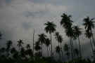
Despite its small size, Israel is home to a variety of
geographic features, from the Negev desert in the south to
the mountain ranges of the Galilee, Carmel and toward the
Golan in the north. The Israeli Coastal Plain on the
shores of the Mediterranean is home to seventy percent of
the nation's population. East of the central highlands
lies the Jordan Rift Valley, which forms a small part of
the 6,500-kilometer (4,039 mi) Great Rift Valley.
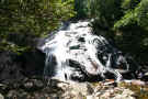
The Jordan River runs along the Jordan Rift Valley,
from Mount Hermon through the Hulah Valley and the Sea of
Galilee to the Dead Sea, the lowest point on the surface
of the Earth. Further south is the Arabah, ending with the
Gulf of Eilat, part of the Red Sea. Unique to Israel and
the Sinai Peninsula are makhteshim, or erosion cirques.
The largest makhtesh in the world is Ramon Crater in the
Negev, which measures 40 by 8 kilometers (25 by 5 mi).A
report on the environmental status of the Mediterranean
basin states that Israel has the largest number of plant
species per square meter of all the countries in the
basin.
Temperatures in Israel vary widely, especially during
the winter. The more mountainous regions can be windy,
cold, and sometimes snowy; Jerusalem usually receives at
least one snowfall each year. Meanwhile, coastal cities,
such as Tel Aviv and Haifa, have a typical Mediterranean
climate with cool, rainy winters and long, hot summers.
The area of Beersheba and the Northern Negev has a
semi-arid climate with hot summers, and cool winter but
with fewer rainy than the Mediterranean climate. The
Southern Negev and the Arava areas have Desert climate
with very hot and dry summers, and mild winters with few
days of rain. The highest temperature in the continent of
Asia (53.7 °C/128.7 °F) was recorded in 1942
at Tirat Zvi kibbutz in the northern Jordan river valley.
From May to September, rain in Israel is rare. With
scarce water resources, Israel has developed various
water-saving technologies, including drip irrigation.
Israelis also take advantage of the considerable sunlight
available for solar energy, making Israel the leading
nation in solar energy use per capita (practically every
house uses solar panels for water heating).
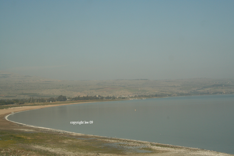
Sea of Galilee
(Yam Kinneret)
|
Location:
|
|
Middle East, bordering the Mediterranean Sea,
between Egypt and Lebanon
|
|
|
Geographic coordinates:
|
|
31 30 N, 34 45 E
|
|
|
|
Area:
|
|
total: 22,072
sq km
country
comparison to the world: 152
land: 21,642
sq km
water: 430
sq km
|
|
|
Area - comparative:
|
|
slightly smaller than New Jersey
|
|
|
Land boundaries:
|
|
total: 1,017
km
border countries: Egypt
266 km, Gaza Strip 51 km, Jordan 238 km, Lebanon
79 km, Syria 76 km, West Bank 307 km
|
|
|
Coastline:
|
|
273 km
|
|
|
Maritime claims:
|
|
territorial sea: 12
nm
continental shelf: to
depth of exploitation
|
|
|
Climate:
|
| Current
Weather
temperate; hot and dry in southern and eastern
desert areas
|
|
|
Terrain:
|
|
Negev desert in the south; low coastal plain;
central mountains; Jordan Rift Valley
|
|
|
Elevation extremes:
|
|
lowest point: Dead
Sea -408 m
highest point: Har
Meron 1,208 m
|
|
|
Natural resources:
|
|
timber, potash, copper ore, natural gas, phosphate
rock, magnesium bromide, clays, sand
|
|
|
Land use:
|
|
arable land: 15.45%
permanent crops: 3.88%
other: 80.67%
(2005)
|
|
|
Irrigated land:
|
|
1,940 sq km (2003)
|
|
|
Total renewable water resources:
|
|
1.7 cu km (2001)
|
|
|
Freshwater withdrawal
(domestic/industrial/agricultural):
|
|
total: 2.05
cu km/yr (31%/7%/62%)
per capita: 305
cu m/yr (2000)
|
|
|
Natural hazards:
|
|
sandstorms may occur during spring and summer;
droughts; periodic earthquakes
|
|
|
Environment - current issues:
|
|
limited arable land and natural fresh water
resources pose serious constraints;
desertification; air pollution from industrial and
vehicle emissions; groundwater pollution from
industrial and domestic waste, chemical
fertilizers, and pesticides
|
|
|
Environment - international agreements:
|
|
party to: Biodiversity,
Climate Change, Climate Change-Kyoto Protocol,
Desertification, Endangered Species, Hazardous
Wastes, Ozone Layer Protection, Ship Pollution,
Wetlands, Whaling
signed, but not ratified: Marine
Life Conservation
|
|
|
Geography - note:
|
|
Lake Tiberias (Sea of Galilee) is an important
freshwater source; there are about 355 Israeli
civilian sites including about 145 small outpost
communities in the West Bank, 41 sites in the
Golan Heights, and 32 in East Jerusalem (2010
est.)
|

Eilat |