|
Overview
The
island of Japan forms an arc in the Pacific Ocean to the
east of the Asian continent. The land comprises four
large islands name (in decreasing order of size) Honshu,
Hokkaido, Kyushu, and Shikoku, together with many smaller
islands. The Pacific Ocean lies to the east while
the Sea of Japan and the East China Sea separate Japan
from the Asian continent.
Japan's
total land area is about 378,000 square km, which is
approximately the same size as Germany, Finland, Vietnam,
or Malaysia. As warm ocean current known as the
Kuroshio flows northeastward along the southern part of
the Japanese archipelago, and a branch of it, known as the
Tsushima Current, flows into the Sea of Japan along the
west side of the country. From the north, a cold
current known as the Oyashio flows south along Japan's
east coast, and a branch of it, called the Liman Current,
enters the Sea of Japan from the north. The mixing of
these warm and cold currents helps produce abundant fish
resources in waters near Japan.
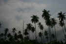
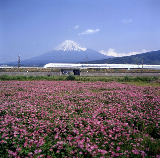
About
3/4 of Japan's land surface is mountainous. The
Chubu Region of central Honshu is known as the "roof
of Japan" and has many mountains which are more than
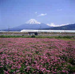
3,000 meters high. Japan's highest mountain is Mt.
Fuji (3,776 m) with Kitadake at 3,192 m being the second
highest.
Since
it is situated along the circum-Pacific volcanic belt,
Japan has several volcanic regions - usually considered to
number 7- from the far north to the far south. Of
all the volcanoes, about 80 are considered active,
including Mr. Mihara, Mt. Asama and Mr. Aso.
Incredibly, Japan has about 1/10 of the world's
approximately 840 active volcanoes, this in spite if it's
small land area (about 1/400 of the world's land area).
Mt. Fuji, which as been dormant for almost 300 years, is
still capable of erupting again in our lifetime. All
the instability under the Japanese archipelago is
conducive for earthquakes, thus placing Japan among those
countries most likely to suffer from them.
Back
to Top
GEOGRAPHY
Japan
is an island with a coastline ranging from long, sandy
beaches to areas with steep cliffs. The country
forms an arc and contains four large islands and many
smaller ones. Approximately the same size as
Malaysia or Germany, Japan has a total land area of about
378,000 sq km. To put it into further perspective,
it's smaller than the state of California and about 1/25
the size of the United States.
On
Japan's east is the Pacific Ocean and on the west is the
Sea of Japan and the East China Sea. These two seas,
incidentally, are all that separate Japan from China.
Being in the middle of all these bodies of water with
their warm and cold currents has it's advantages, a great
abundance of fish! The currents flow in different
directions around Japan. The warm currents flow from
the southern part of Japan, northward with a cold current
flowing from the north going south. These currents
split, thus branching off and flowing on both the east and
west side of Japan.
Back
to Top
VOLCANOES
AND EARTHQUAKE
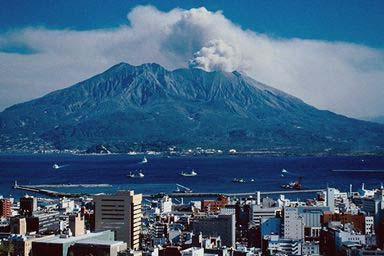
Volcano
Sakurajima Kagoshima
The
majority of Japan's land is mountainous, totaling
approximately 75%. Central Honshu's Chubu Region is
incredible with many mountains exceeding 3,000 in height,
which is why it's aptly named "the roof of
Japan".
The
highest mountain in Japan is Mt. Fuji, at an impressive
3,776 meters. Mt. Fuji can be found bordering the
Yamanashi and Shizuika Prefectures. It's easy
to forget that this impressive and beautiful mountain is
actually a volcano. Although it hasn't erupted since
1707, Mt. Fuji is not considered a dormant volcano and
could erupt again in the future.
Actually,
many mountainous regions, about seven of them, are
considered to be volcanic. These regions go from the
far north all the way down to the far south. The
reason for the high number of volcanic areas is because
Japan is located along the circum-Pacific volcanic belt.
Of the 840 active volcanoes in the world, Japan has almost
1/10 of them (approximately 80) even though Japan has only
1/400 of the world's land area! A
positive aspect of volcanoes is the money brought in by
tourists. Tourists go to see the beautiful scenery
and go to the surrounding hot springs as well.
It
is apparent by all Japan's volcanoes that there is a lot
of instability in the Earth's crust below. This
instability, and high energy, attributes to the
approximately 1,000 earthquakes Japan experiences every
year. Most of these are not serious and don't cause
extensive damage, but are simply those that are strong
enough to be felt.
Back
to Top
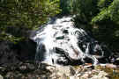
CLIMATE
A
major feature of Japan's climate is the clear-cup
temperature changes between the four seasons. From
north to south, Japan covers a range of latitude of some
25 degrees and is influenced in the winter by seasonal
winds blowing from Siberia and in the summer by seasonal
winds blowing from the pacific Ocean. In spite of
it's rather small area, Japan is characterized by four
different climatic patterns.
Hokkaido,
with a subarctic weather pattern, has a yearly average
temperature of eight degrees centigrade and receives an
average annual precipitation of 1,150 millimeters.
The Pacific Ocean side of Japan, from the Tohoju region of
northern Honshu to Kyushu, belongs to the temperate zone,
and its summers are hot, influenced by seasonal winds from
the Pacific. The side of the country which faces the
Sea of Japan has a climate with much rain and snow,
produced when cold. moisture-bearing seasonal winds from
the continent are stopped in their advance by the Central
Alps and other mountains which run along Japan's center
like a backbone, The southwestern islands of Okinawa
Prefecture belong to the subtropical climate zone and have
a yearly average temperate of over 22 degrees, while
receiving over 2,000 millimeters of precipitation.
Back
to Top
Spring
(March, April, May)
When
winters nears its end, the cold seasonal winds blowing
from the continent become weaker and more intermittent.
At this time, low pressure air masses originating in China
enter the Sea of Japan; these give rise to strong, warm
southerly winds which travel toward this low-pressure zone
from the Pacific Ocean. The first of these winds is
called haru ichiban. While it announces the
warmth of the coming spring, it sometimes causes
avalanches and, crossing the mountains to the side of the
country facing the Sea of Japan, it is at times
responsible for exceptionally hot and dry weather and can
even become the cause of large fires.
In
early spring, plum blossoms appear, followed by peach
blossoms. During the last ten days or so of March,
the cherry blossoms so beloved by the Japanese people
begin to bloom.
Back
to Top
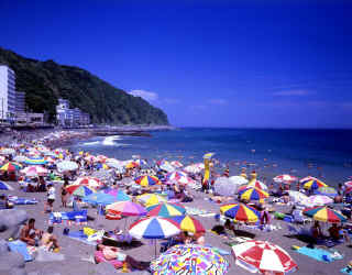
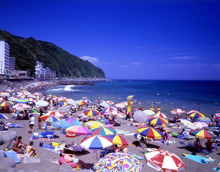
Summer
(June, July, August)
Before
the arrival of real summer-like weather, Japan has a damp
rainy season know as baiu. From May until
July, there is a high-pressure mass of cold air above the
Sea of Okhotsk to the north of Japan, while over the
Pacific Ocean there develops a high-pressure mass of warm,
moist air. Along the line where these cold and warm
air masses meet, known as the baiu zensen, which
extends from southern China over the Japanese archipelago,
causes prolonged periods of continuous rainfall.
After
the middle of July, high-pressure air masses over the
Pacific Ocean become predominant and the rainy season
comes to an end as the baiu zensen is pushed
northward. Seasonal winds from the Pacific Ocean
bring warm, moist air to Japan, and the country has hot
summer weather with many days when temperatures rise to
more than 30 degrees centigrade.
Back
to Top
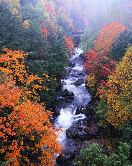
Autumn
(September, October, November)
From
the end of summer through September, Japan is often struck
by typhoons. Typhoons originate from large masses of
tropical low-pressure air in the North Pacific between the
latitudes of approximately 5 and 20 degrees, and are the
same phenomenon as hurricanes and cyclones in other parts
of the world. When a typhoon begins to take shape,
it gradually moves north. Every year, during this
period, around 30 typhoons form, of which on the average
about 4 reach Japan, sometimes causing great destruction.
After
the middle or latter part of October, Japan enjoys
generally clear weather; it is neither hot nor cold.
The country also enjoys especially fine weather at the
beginning of November. Many of the trees take on
bright autumn colors, making this time of the year,
together with the time of new greenery in the spring, a
truly beautiful season.
Back
to Top
Winter
(December, January, February)
Toward
the end of November, cold seasonal winds begin blowing
over Japan from the continent. These northwesterly
winds pick up moisture over the Sea of Japan and drop much
of this moisture in the form of rain and snow on the
western side of Japan as they are impeded in their eastern
advance by the ridge of mountains that runs through the
central part of the country. The Hokuriku region
(Fukui, Ishikawa, Toyama, and Niigata prefectures), which
faces the Sea of Japan and is separated from other regions
of Japan by high mountains, is known for its deep snows.
By
contrast, the Pacific side of the country enjoys generally
clear skies during the winter season. In Tokyo,
despite the fair skies, winter temperatures average around
5 degrees, a difference of 25 degrees from summer
temperatures of 30 degrees or more.
The
islands of Okinawa Prefecture in the far southwest have a
subtropical climate with less marked temperature
differences between the seasons. Winter temperatures
there are much more moderate than in other parts of the
country.
Back
to Top
Information
provided by the Japanese Embassy
|
Location:
|
|
Eastern Asia, island chain
between the North Pacific Ocean and the Sea of
Japan, east of the Korean Peninsula
|
|
|
Geographic coordinates:
|
|
36 00 N, 138 00 E
|
|
|
Map references:
|
|
Asia
|
|
|
Area:
|
|
total: 377,915
sq km
country
comparison to the world: 61
land: 364,485
sq km
water: 13,430
sq km
note: includes
Bonin Islands (Ogasawara-gunto), Daito-shoto,
Minami-jima, Okino-tori-shima, Ryukyu Islands (Nansei-shoto),
and Volcano Islands (Kazan-retto)
|
|
|
Area - comparative:
|
|
slightly smaller than
California
|
|
|
Land boundaries:
|
|
0 km
|
|
|
Coastline:
|
|
29,751 km
|
|
|
Maritime claims:
|
|
territorial sea: 12
nm; between 3 nm and 12 nm in the international
straits - La Perouse or Soya, Tsugaru, Osumi, and
Eastern and Western Channels of the Korea or
Tsushima Strait
contiguous zone: 24
nm
exclusive economic zone: 200
nm
|
|
|
Climate:
|
| Current
Weather
varies from tropical in south
to cool temperate in north
|
|
|
Terrain:
|
|
mostly rugged and mountainous
|
|
|
Elevation extremes:
|
|
lowest point: Hachiro-gata
-4 m
highest point: Fujiyama
3,776 m
|
|
|
Natural resources:
|
|
negligible mineral resources,
fish
note: with
virtually no energy natural resources, Japan is
the world's largest importer of coal and liquefied
natural gas, as well as the second largest
importer of oil
|
|
|
Land use:
|
|
arable land: 11.64%
permanent crops: 0.9%
other: 87.46%
(2005)
|
|
|
Irrigated land:
|
|
25,920 sq km (2003)
|
|
|
Total renewable water
resources:
|
|
430 cu km (1999)
|
|
|
Freshwater withdrawal
(domestic/industrial/agricultural):
|
|
total: 88.43
cu km/yr (20%/18%/62%)
per capita: 690
cu m/yr (2000)
|
|
|
Natural hazards:
|
|
many dormant and some active
volcanoes; about 1,500 seismic occurrences (mostly
tremors) every year; tsunamis; typhoons
volcanism: both
Unzen (elev. 1,500 m, 4,621 ft) and Sakura-jima
(elev. 1,117 m, 3,665 ft), which lies near the
densely populated city of Kagoshima, have been
deemed "Decade Volcanoes" by the
International Association of Volcanology and
Chemistry of the Earth's Interior, worthy of study
due to their explosive history and close proximity
to human populations; other notable historically
active volcanoes include Asama, Honshu Island's
most active volcano, Aso, Bandai, Fuji, Iwo-Jima,
Kikai, Kirishima, Komaga-take, Oshima,
Suwanosejima, Tokachi, Yake-dake, and Usu
|
|
|
Environment - current issues:
|
|
air pollution from power plant
emissions results in acid rain; acidification of
lakes and reservoirs degrading water quality and
threatening aquatic life; Japan is one of the
largest consumers of fish and tropical timber,
contributing to the depletion of these resources
in Asia and elsewhere
|
|
|
Environment - international
agreements:
|
|
party to: Antarctic-Environmental
Protocol, Antarctic-Marine Living Resources,
Antarctic Seals, Antarctic Treaty, Biodiversity,
Climate Change, Climate Change-Kyoto Protocol,
Desertification, Endangered Species, Environmental
Modification, Hazardous Wastes, Law of the Sea,
Marine Dumping, Ozone Layer Protection, Ship
Pollution, Tropical Timber 83, Tropical Timber 94,
Wetlands, Whaling
signed, but not ratified: none
of the selected agreements
|
|
|
Geography - note:
|
|
strategic location in northeast
Asia
|
|