|

Laos's
Geography
Laos'
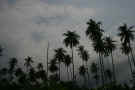
landscape is characterized by precipitous mountains; long,
fertile floodplains, and lastly, high plateaus. The
mountains are found all throughout Laos but are mainly in
the northern part of the country as are three main
plateaus which are found in the north, central and
southern sections of the country. The floodplains
span from the north, where they are narrow, to the south
where they are much wider.
The
tropical monsoon climate of Laos has average temperatures
ranging from 28 degrees C to 38 degrees C. The
mountainous areas generally stay much cooler with average
temperatures of 15 degrees C during winter. Laos'
rainy season is from May to September, while the dry
season is from October to April.
The
most important river in Laos is the Mekong River with it
being navigable through most of Laos.
|
Location:
|
|
Southeastern
Asia, northeast of Thailand, west of Vietnam
|
|
|
Geographic
coordinates:
|
|
18 00 N, 105 00
E
|
|
|
Map
references:
|
|
Southeast
Asia
|
|
|
Area:
|
|
total: 236,800
sq km
country
comparison to the world: 83
land: 230,800
sq km
water: 6,000
sq km
|
|
|
Area -
comparative:
|
|
slightly larger
than Utah
|
|
|
Land
boundaries:
|
|
total: 5,083
km
border
countries: Burma
235 km, Cambodia 541 km, China 423 km, Thailand
1,754 km, Vietnam 2,130 km
|
|
|
Coastline:
|
|
0 km
(landlocked)
|
|
|
Maritime
claims:
|
|
none
(landlocked)
|
|
|
Climate:
|
| Current
Weather
tropical
monsoon; rainy season (May to November); dry
season (December to April)
|
|
|
Terrain:
|
|
mostly rugged
mountains; some plains and plateaus
|
|
|
Elevation
extremes:
|
|
lowest point: Mekong
River 70 m
highest point: Phu
Bia 2,817 m
|
|
|
Natural
resources:
|
|
timber,
hydropower, gypsum, tin, gold, gemstones
|
|
|
Land use:
|
|
arable land: 4.01%
permanent
crops: 0.34%
other: 95.65%
(2005)
|
|
|
Irrigated
land:
|
|
1,750 sq km
(2003)
|
|
|
Total
renewable water resources:
|
|
333.6 cu km
(2003)
|
|
|
Freshwater
withdrawal (domestic/industrial/agricultural):
|
|
total: 3
cu km/yr (4%/6%/90%)
per capita: 507
cu m/yr (2000)
|
|
|
Natural
hazards:
|
|
floods,
droughts
|
|
|
Environment
- current issues:
|
|
unexploded
ordnance; deforestation; soil erosion; most of the
population does not have access to potable water
|
|
|
Environment
- international agreements:
|
|
party to: Biodiversity,
Climate Change, Climate Change-Kyoto Protocol,
Desertification, Endangered Species, Environmental
Modification, Law of the Sea, Ozone Layer
Protection
signed, but not
ratified: none
of the selected agreements
|
|
|
Geography -
note:
|
|
landlocked;
most of the country is mountainous and thickly
forested; the Mekong River forms a large part of
the western boundary with Thailand
|
|
|
|
|