Overview
With an
aggressive effort since 1949, by the Chinese
government to improve their country, a comprehensive
transportation system was created. It consisted of
railways, highways, airplanes and water
transportation. Just before 1950, there were only
21,800 km of railway lines available, but by the
time 1998 arrived, there were 57,600-km lines of
railway lines open.
Beijing is
the hub for the railway line that heads north to
south, consisting of the following lines:
Beijing-Guangzhou Railway, Beijing-Shanghai Railway,
Beijing-Kowloon Railway and the Beijing-Harbin
Railway. The line that heads from west to east has
its hub located in Zhengzhou. Railways from China to
Holland now connect Asia and Europe. Newer lines
have been built in southern China.
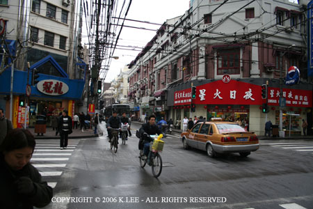
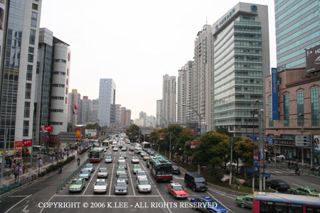
All town and counties are easy to reach through the
development of the highway system, with nearly 1.278
million km stretching across the country. Compare
that to the length of highways in 1949. 80,000 km.
Now, towns, counties and townships that were once
inaccessible, are within reach. Major expressways
such as: Shenyang-Dalian, Beijing-Tianjin-Tanggu,
Guangzhou-Shenzhen, Jinan-Qingdao and
Yichang-Huangshi are a few examples. In 1998 alone,
37,000 km of highways were built, of those 1,487 km
were expressways.
During
the reformation, China worked hard at building and
expanding airports. Between 1949 and 1978, China was
willing to invest lots of money to expand and build
airports. Since then, airports have been built to
accommodate the needs of economic development. By
1998, there were more than 140 airports opened. The
hub of air travel is based in Beijing, with Beijing
being the base for international travel.
Travel
from places as far off as Tokyo, Bangkok, Jakarta,
Paris, Frankfurt, Moscow, London, New York and
Vancouver. Also, airlines depend on Beijing to all
the provinces, regions, the open cities, border and
remote areas.
Back
to Top
Another
method of travel in China is via the waterways. With
a coast of 18,000 km it is understandable why it can
provide such convenience for inland development. The
main rivers that are inland are the Yangtze, the
Pearl, the Heilongjiang, the Huaihe, the Quiantang,
the Minjiang and the Huangpu. The Yangtze is
considered to be the "golden waterway". It
is used for both freight and passenger
transportation. The shipping out in the ocean off of
China is divided up into two zones, the northern and
the southern.
The
northern zone consists of Shanghai as Dalian as the
main shipping hubs. The southern hub has Guangzhou.
Today the Shanghai Harbor is one of the largest
harbors in the world, amongst the 20 other coastal
harbors that inhabit China. By 1998 alone, there
were over 12 billion people using water
transportation as a means of traveling.
Another
source of travel, is via telecommunications. Before
1978, there were no mobile telecommunications within
China. But during 1978, optical cable lines expanded
to 173,000 km. By 1998, mobile phone capacity was a
high levels with just over 110 million users. Just
over 10% of China’s population. Soon, China was
the third-largest market for mobile phones in the
world. Now, all large and at least mid-sized cities,
have up to date services. Services that provide:
international express mail service, international
automatic telex, data transmission, express fax and
TV program transmission services.
Back
to Top
Not
to be forgotten, is also the various services
available over the Internet such as e-mail and
e-commerce. The use of data communications have
grown from nothing, to an efficient network.
Since
the founding of the PRC in 1949, China has formed a
comprehensive transportation system comprehending
railways, a posts and telecommunications network
accessible from all directions. As the market
economy system was established after the initiation
of the policies of reform and opening to the outside
world in 1978, historic changes took place in
transport, posts and telecommunications - they have
developed quickly and are heading for openness and
competition, emerging from a closed and monopolistic
state.
By
the end of 1998, the total length of transportation
lines in China had reached 2.98 million km, 16 times
and 2.4 times the lengths in 1949 and 1978
respectively; the total length of optical cable
lines had reached 173,000 km from zero in 1978.
In 1978, there were no mobile telecommunications in
China; however, by the end of 1998, the nation's
total mobile phone exchange capacity had reached
43.65 million users. Mobile telecommunications
have developed to the extent of using analogue and
digital networks, and realized automatic roaming
with some countries and regions. Data
telecommunications have grown from nothing to the
stage of having an efficient network.
Back
to Top
RAILWAYS
In
1949, there were only 21,800 km of railway lines in
China, with only 11,000 km opened to traffic.
Between 1979 and 1998, newly constructed lines
opened to traffic reached 14,979 km, of which
electrified lines totaled 11,176 km. In 1998,
the length of railway lines opened to traffic
reached 57,600, a 18.5 percent increase over 1978.
There
are north-south and west-east trunk lines in China.
The north-south line, with Beijing as its hub,
consists of the Beijing-Guangzhou Railway,
Beijing-Shanghai Railway, Beijing-Kowloon Railway
and Beijing-Harbin Railway. The west-east
line, with Zhengzhou as its hub, consists of the
Lianyunggang-Lanzhou Railway and Lanzhou-Urumqi
Railway. The latter has been extended westward to
link up with the railways in Kazakhstan.
Thus
Asia and Europe are linked by railways from
Linayungang in China to Rotterdam in Holland.
New railway lines have been built in mountainous
areas in southwestern China, mainly the
Chendu-Chongqing Railway, Baoji-Chengdu Railway,
Chengdu-Kunming Railway and the Nanning-Kunming
Railway. Besides, the Turpan-Kashi Railway has
been newly built in the Xinjiang Uygur Autonomous
Region.
Back
to Top
HIGHWAYS
In
1949, the length of highways in China was just over
80,000 km and more than one third of the counties
nationwide were not accessible by road.
However, by 1998, the total length of highways
opened to traffic had reached 1.278 million km.
Now, all counties, town and townships are accessible
by road.
After
1978, China began to build a large number of
expressways, including the Shenyang-Dalian, Beijing-Tianjin-Tanggu,
Guangzhou-Shenzhen, Jinan-Qingdao, Chengdu-Chongqing,
Yichang-Huangshi, Beijing-Shijiazhuang,
Shijianzhuang-Taiyuan, Shanghai-Ningbo and
Taiyuan-Jiuguan expressways. In 1998, there
were 37,000 km of newly built highways, 1,487 km of
which were expressways.
Back
to Top
CIVIL
AVIATION
Between
1949 and 1978, China invested several billion yuan
to construct and expand a group of airports, laying
the foundation for civil aviation in the country.
Since the initiation of the policies of reform and
opening, a group of airports have been built and
expanded to satisfy the needs of economic
development.
By
the end of 1998, there were over 140 airports opened
to civil airplanes. Of them, more than 80
could accommodate large airplanes such as Boeing
777s, 767s, 757s, 747s and 737s and A340s. By
1998, the total length of civil air routes in China
was 1.506 million km, 10.1 times that in 1978, and
1.122 air routes had been opened, 131 of which were
international air routes.
The
domestic airlines radiate from Beijing to all
provinces, autonomous regions and municipalities,
all open cities, and border and remote areas.
The international airlines reach more than 50
cities, including Tokyo, Bangkok, Jakarta, Paris,
Frankfurt, Moscow, London, New York and Vancouver.
Back
to Top
WATER
TRANSPORT
China's
mainland coast is over 18,000 km long, and its
rivers total 220,000 km in length. Such
excellent natural conditions provide convenience for
developing inland river transport and ocean
shipping.
The
major inland navigable rivers in China are the
Yangtze, the Pearl, the Heilongjiang, the Huaihe,
the Qiantang, the Minjiang, and the Huangpu, not
forgetting the Grand Canal between Beijing and
Hangzhou. In 1998, navigable inland waterways
in China totaled 110,000 km, the volume of cargo
transportation was 1940.6 billion tons/km, and the
volume of passenger transportation was 12 billion
persons/km. Now there are more than 5,000
berths at some 70 major inland river ports.
The Yangtze, the "golden waterway" of
China's inland river transport, has considerable
annual volume of both freight and passenger
transport.
Nanjing
Harbor, the largest river harbor in China, has an
annual capacity of 40 million tons. Ocean
shipping in China is divided into two major
navigation zones: the northern and the southern
ones. The northern one has Shanghai and Dalian
as the centers, and the southern one has Guangzhou
as the center.
Harbors
(including inland river ports) built after 1978 have
an annual capacity of 471.34 million tons.
There are more than 20 major coastal harbors in
China, of which Shanghai Harbor ranks among the 10
largest trade harbors in the world, with an annual
capacity of over 100 million tons. China has
an ocean fleet with a capacity of 22 million tons of
goods, sailing among 1,100 harbors worldwide.
Back
to Top
POSTS
AND TELECOMMUNICATIONS
Since
1978, the development of posts and
telecommunications has entered a new historical
stage. The scale and volume of the telephone
network, and the level of technology and services
have all realized qualitative leaps. China has
built up its public telecommunications network to
cover the whole nation and link it up with the rest
of the world.
The
public postal network now boasts complete services
and multiple transportation means. Many
advanced methods are used, including optical cables,
digital microwave networks, satellites,
program-controlled exchanges, mobile
telecommunications and data telecommunications.
Back
to Top
By
the end of 1998, the nation's total mobile telephone
exchange capacity had reached 130 million circuits,
and the number of mobile telephone users had reached
23.86 million, making China the third largest market
for mobile phones in the world. The total
number of telephone users in China reached 110
million in 1998, accounting for 10.6 percent of the
nation's population, while the percentage in 1978
was 0.38 percent; and in urban areas, the percentage
in 1998 was 27.7 percent, while in 1978 it was only
1.9 percent.
In
rural areas, 67 percent of the administrative
villages now have telephones. Chinas has
102,000 post offices nationwide, and the total
length of postal routes and rural mail delivery
routes reaches 6.215 million km. All large and
medium-sized cities provide international express
mail service, and have developed international
automatic telex, data transmission, express fax, and
TV program transmission services. Besides,
various services via the Internet, including e-mail
and e-commerce, are now available.
Back
to
|