|

Malaysia's
Geography
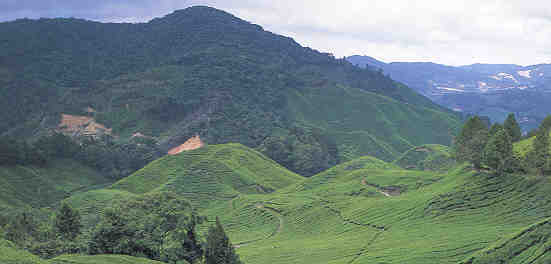
Malaysia sits
on the South China Sea in the center of Southeast Asia. The country is crescent-
shaped, starting with Peninsular Malaysia (West Malaysia) and extends to another region, Sabah
and Sarawak (East Malaysia), located on the island of Borneo. The total area of Malaysia
is approximately 330,000 square km, with most of it located on the island of
Borneo. Peninsular
Malaysia only comprises approximately 40% of the total area.
Malaysia's
climate is hot and humid with relative humidity ranging from 80 - 90 percent,
except in the highlands. The temperature averages from 70-90 degrees F
(20-30 degrees C) throughout the year. The tropical climate is experienced year-round with
the rainy season varying on the
coasts of Peninsular Malaysia. The west coast has it's rainy season from
September through December with the east coast (and Sarawak and Sabah)
experiencing it's from October through February. East Malaysia (the
northern slopes) get up to 5080 mm of rain a year versus West Malaysia's 2500
mm.
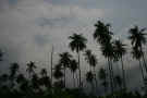
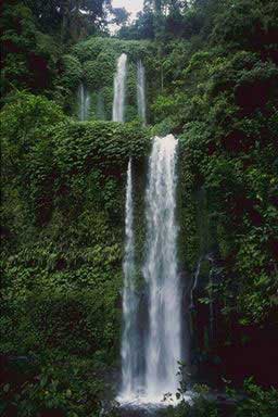
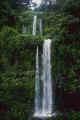
There
are forests covering over half of Malaysia, with notable tropical forests in
Sabah and Sarawak. Deforestation is a problem the country is dealing with
due to logging and hydroelectric projects.
|
Location:
|
|
Southeastern
Asia, peninsula bordering Thailand and northern
one-third of the island of Borneo, bordering
Indonesia, Brunei, and the South China Sea, south
of Vietnam
|
|
|
Geographic
coordinates:
|
|
2 30
N, 112 30 E
|
|
|
Map
references:
|
|
Southeast
Asia
|
|
|
Area:
|
|
total:
329,847
sq km
country
comparison to the world: 66
land: 328,657
sq km
water:
1,190
sq km
|
|
|
Area
- comparative:
|
|
slightly
larger than New Mexico
|
|
|
Land
boundaries:
|
|
total:
2,669
km
border
countries: Brunei
381 km, Indonesia 1,782 km, Thailand 506 km
|
|
|
Coastline:
|
|
4,675
km (Peninsular Malaysia 2,068 km, East Malaysia
2,607 km)
|
|
|
Maritime
claims:
|
|
territorial
sea: 12
nm
exclusive
economic zone: 200
nm
continental
shelf: 200
m depth or to the depth of exploitation; specified
boundary in the South China Sea
|
|
|
Climate:
|
| Current
Weather
tropical;
annual southwest (April to October) and northeast
(October to February) monsoons
|
|
|
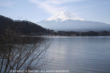
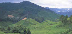
Terrain:
|
|
coastal
plains rising to hills and mountains
|
|
|
Elevation
extremes:
|
|
lowest
point: Indian
Ocean 0 m
highest
point: Gunung
Kinabalu 4,100 m
|
|
|
Natural
resources:
|
|
tin,
petroleum, timber, copper, iron ore, natural gas,
bauxite
|
|
|
Land
use:
|
|
arable
land: 5.46%
permanent
crops: 17.54%
other:
77%
(2005)
|
|
|
Irrigated
land:
|
|
3,650
sq km (2003)
|
|
|
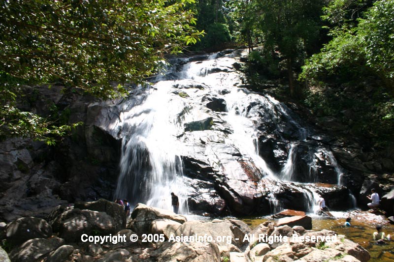
Total
renewable water resources:
|
|
580 cu
km (1999)
|
|
|
Freshwater
withdrawal (domestic/industrial/agricultural):
|
|
total:
9.02
cu km/yr (17%/21%/62%)
per
capita: 356
cu m/yr (2000)
|
|
|
Natural
hazards:
|
|
flooding;
landslides; forest fires
|
|
|
Environment
- current issues:
|
|
air
pollution from industrial and vehicular emissions;
water pollution from raw sewage; deforestation;
smoke/haze from Indonesian forest fires
|
|
|
Environment
- international agreements:
|
|
party
to: Biodiversity,
Climate Change, Climate Change-Kyoto Protocol,
Desertification, Endangered Species, Hazardous
Wastes, Law of the Sea, Marine Life Conservation,
Ozone Layer Protection, Ship Pollution, Tropical
Timber 83, Tropical Timber 94, Wetlands
signed,
but not ratified: none
of the selected agreements
|
|
|
Geography
- note:
|
|
strategic
location along Strait of Malacca and southern
South China Sea
|

|